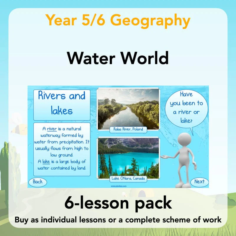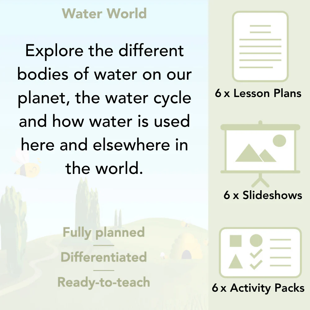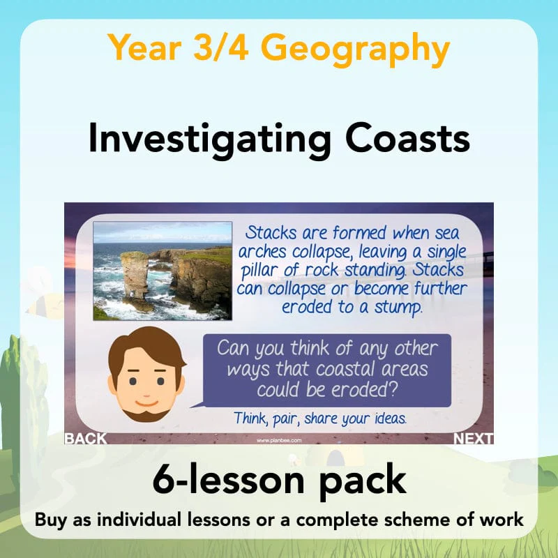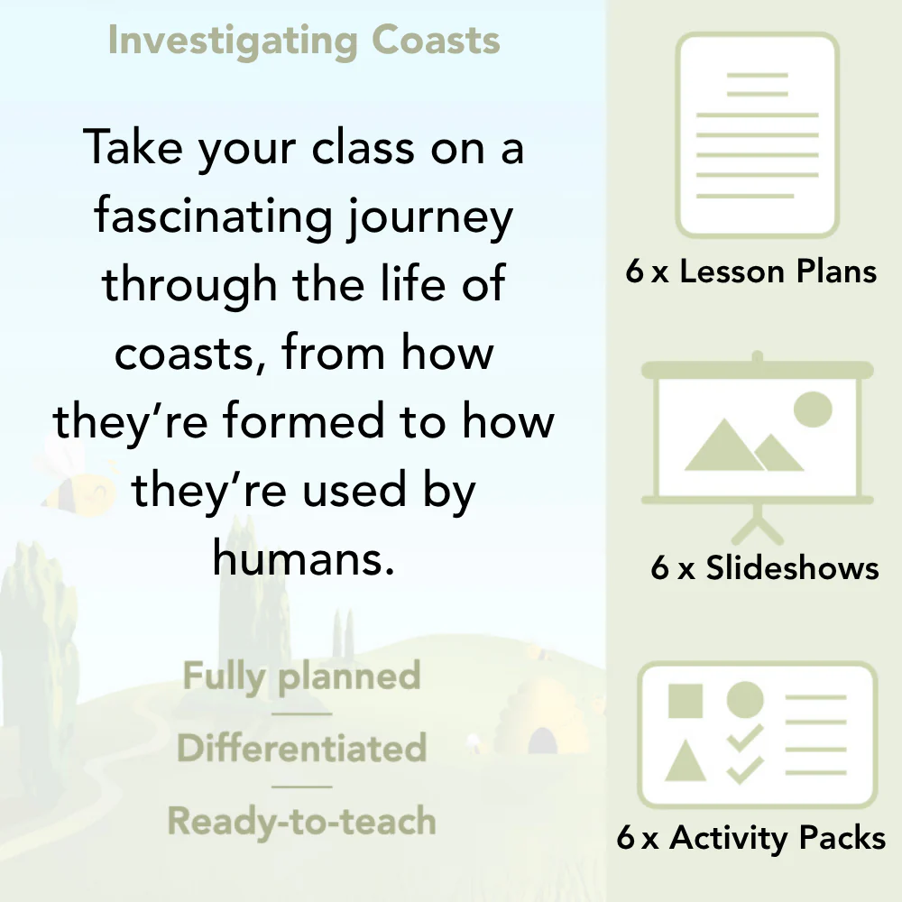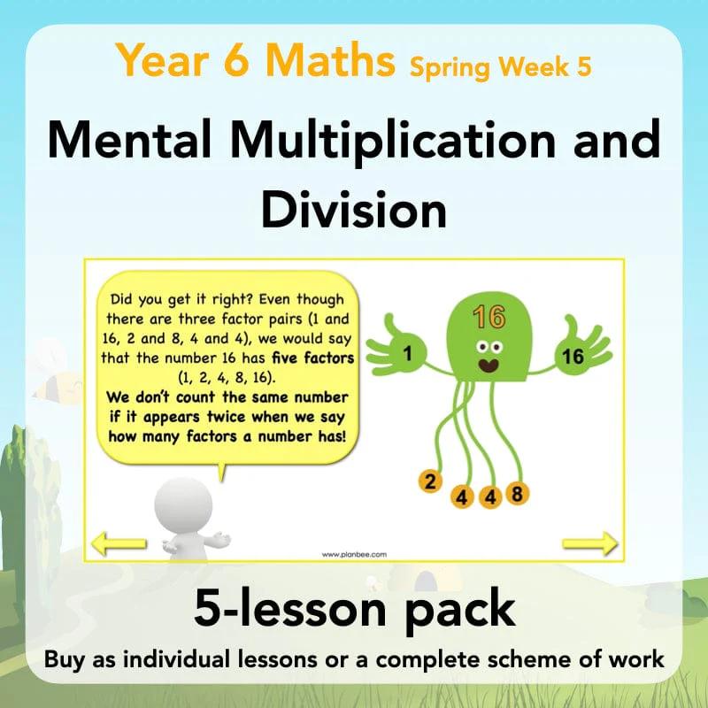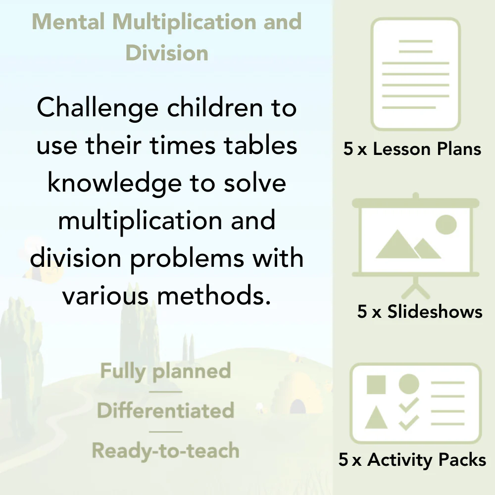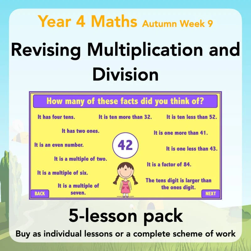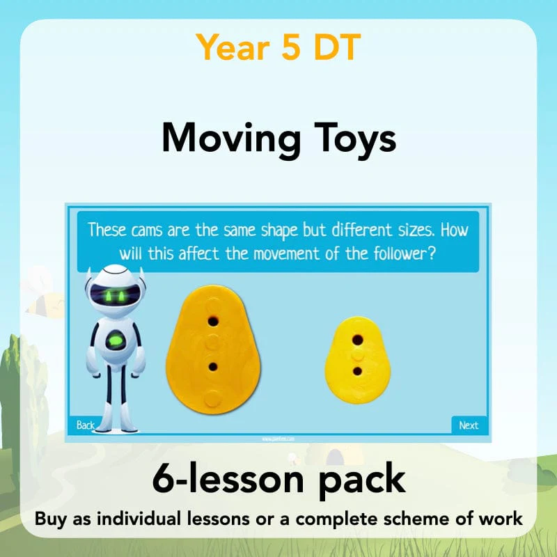
Map Makers
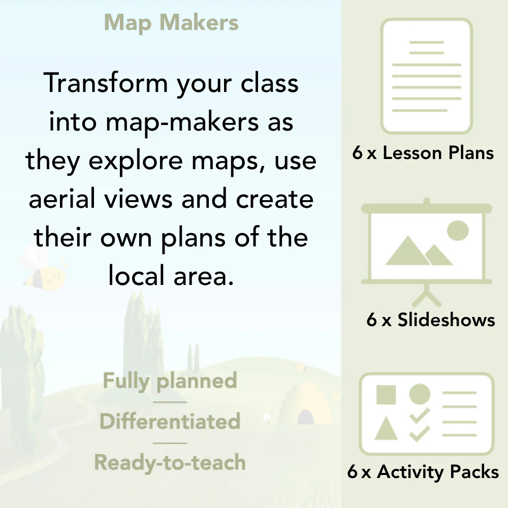
Give your class the opportunity to learn all about maps and the geography of their surrounding area with these 'Map Makers' lessons for Year 2. Your class will find out why we use maps and how to read them, as well as having the opportunity to draw their own maps and plan perspectives.
This scheme of work provides opportunities for your class to perfect their map reading skills and put them into practise in school and the surrounding local area. These KS1 'Map Makers' lessons are sure to have your class excited about making and using maps! This downloadable series of lessons includes lesson plans, slideshow presentations and printable teaching resources.
Compass Points
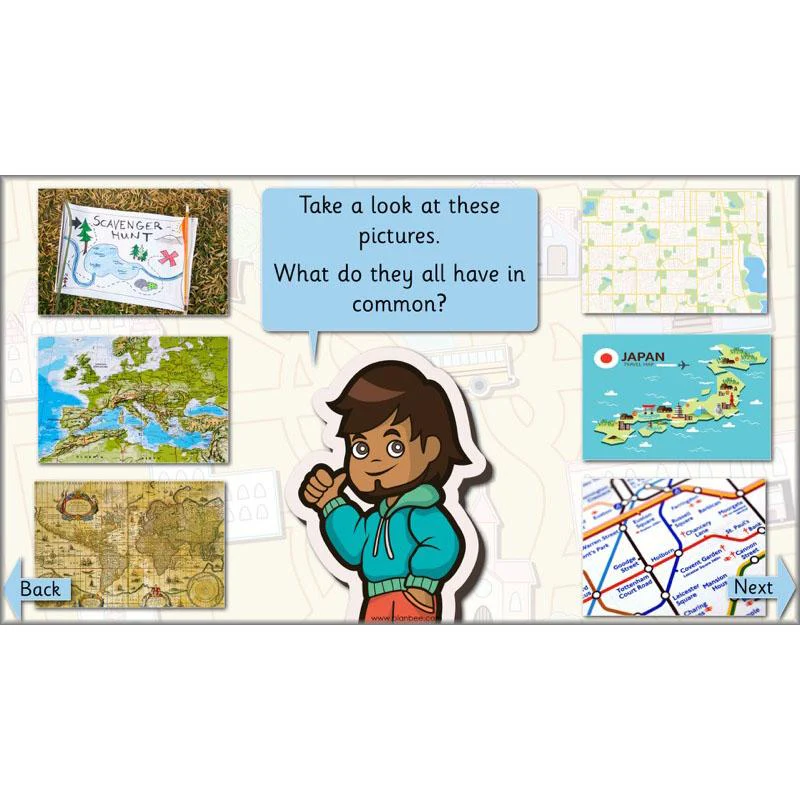
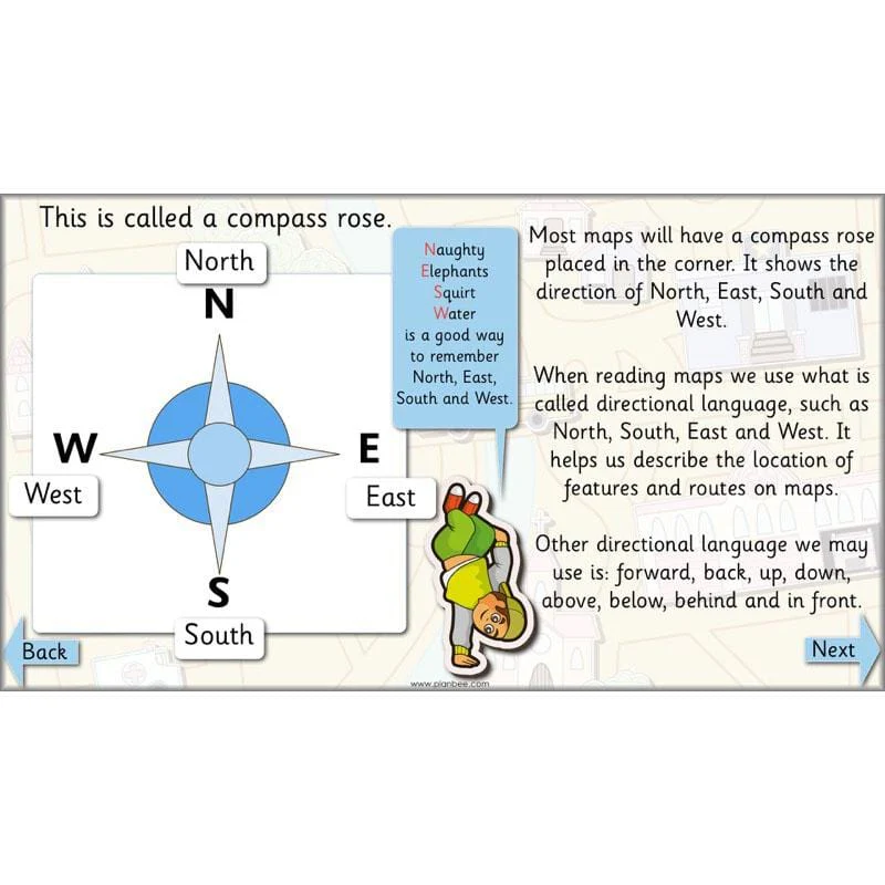
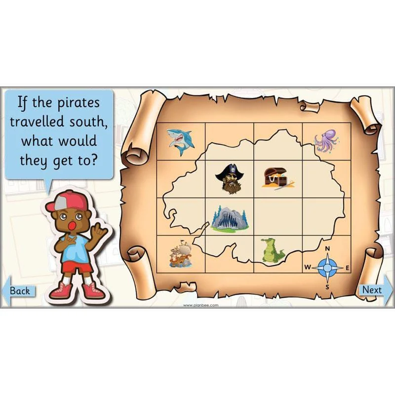
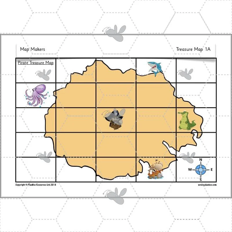
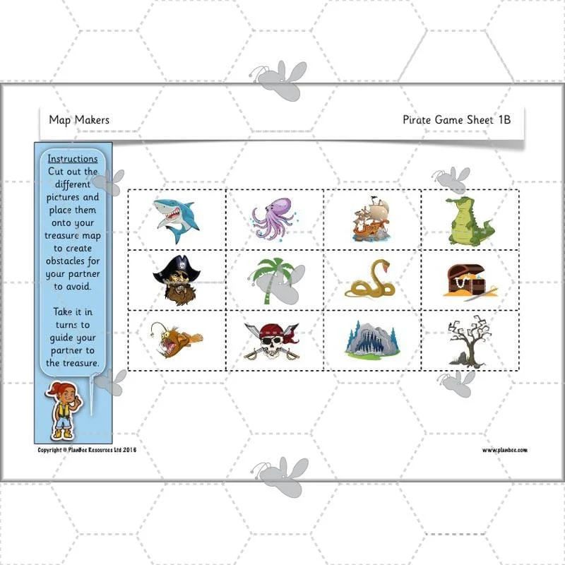
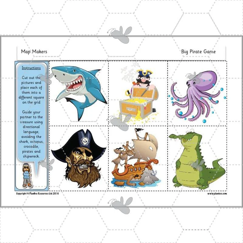
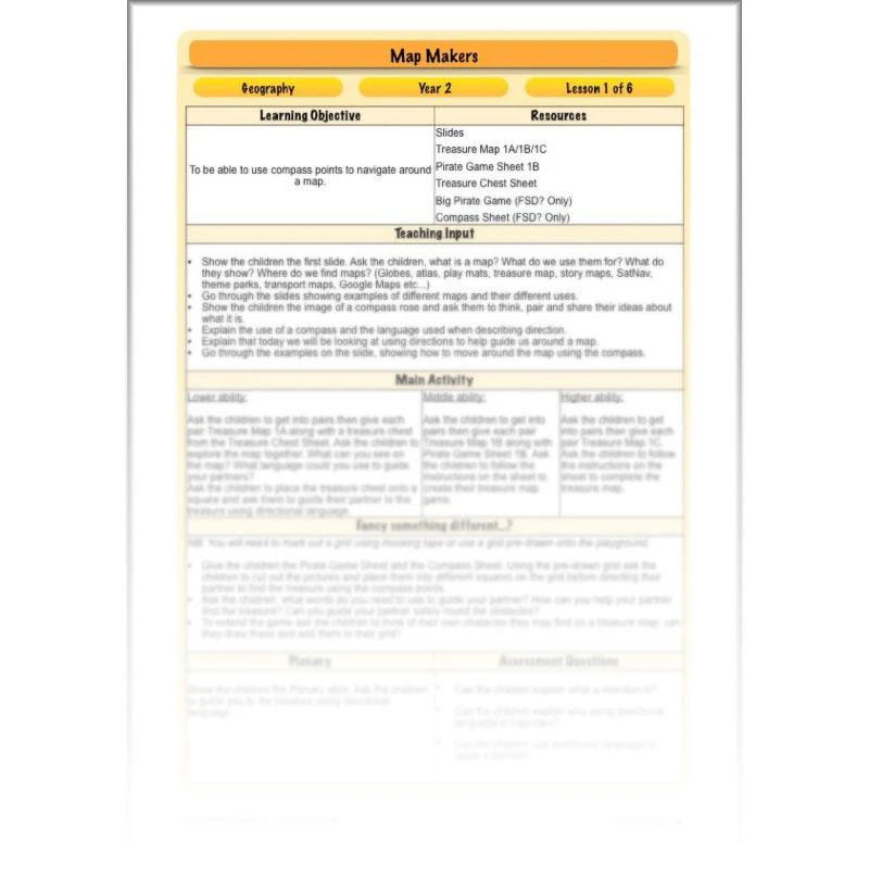
The first lesson in this scheme of work introduces your class to maps. Your children will explore different uses of maps, asking the questions, ‘What are maps?’, ‘Where do we find them?’ and ‘What do we use them for?’ Your class will learn about directional language and how to move around a map using the points of a compass. Different types of maps will be shown in this lesson and children will begin to understand what these maps show and how they help us.
This downloadable lesson includes a lesson plan, a slideshow presentation and printable teaching resources.
What's included:
- Lesson plan
- Slides
- Activity ideas
- Differentiated treasure maps
- Pirate game sheet
- Treasure chest sheet
- Compass sheet
View Lesson 1
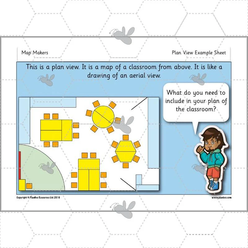
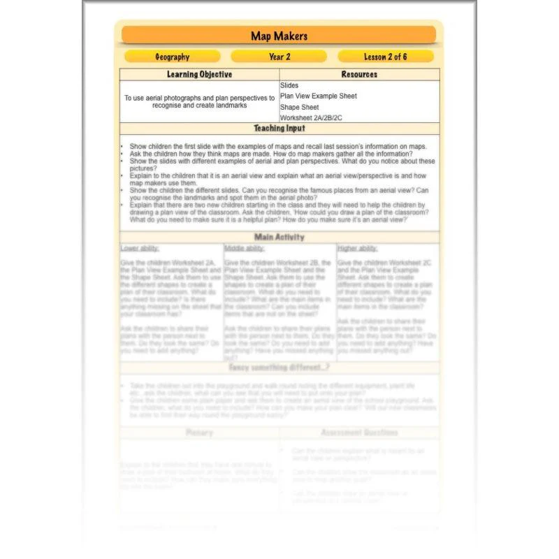
Aerial Views and Plan Perspectives
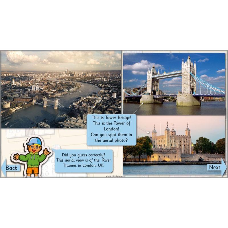
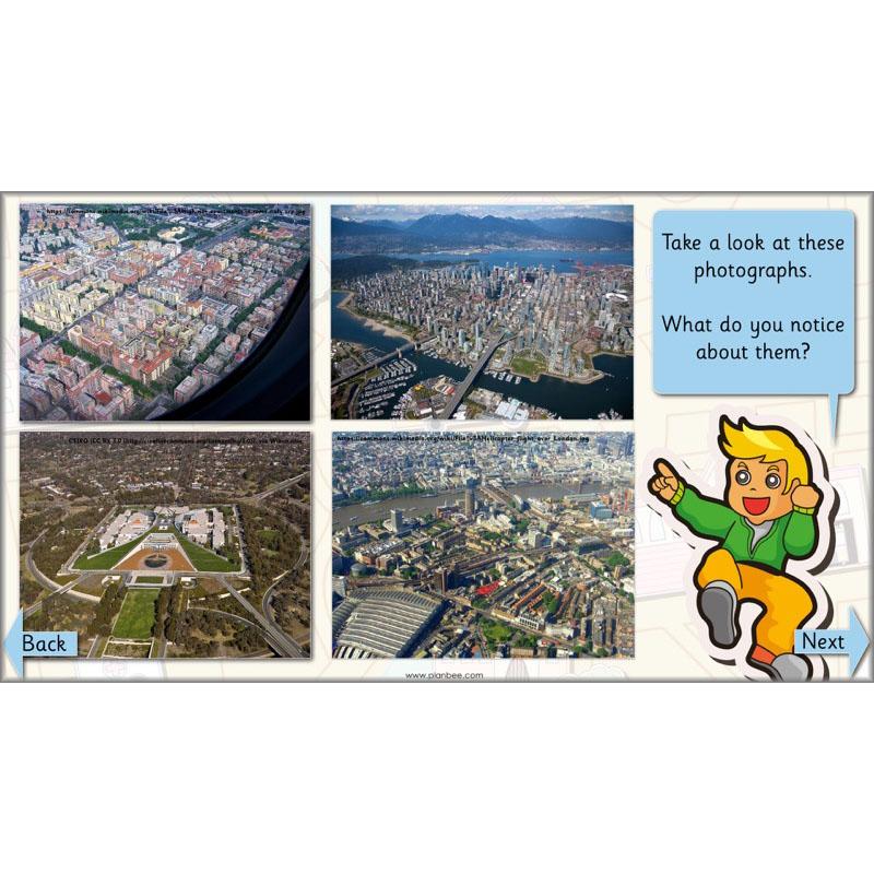
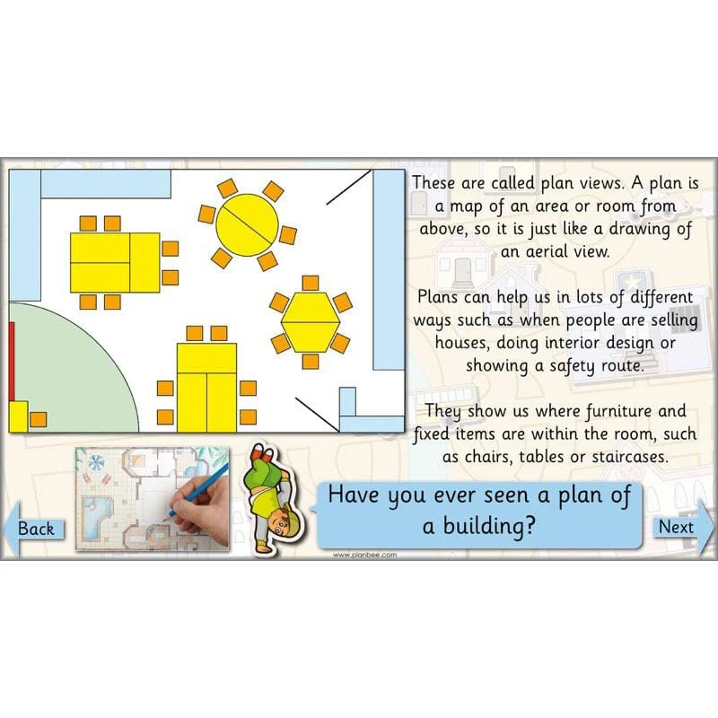
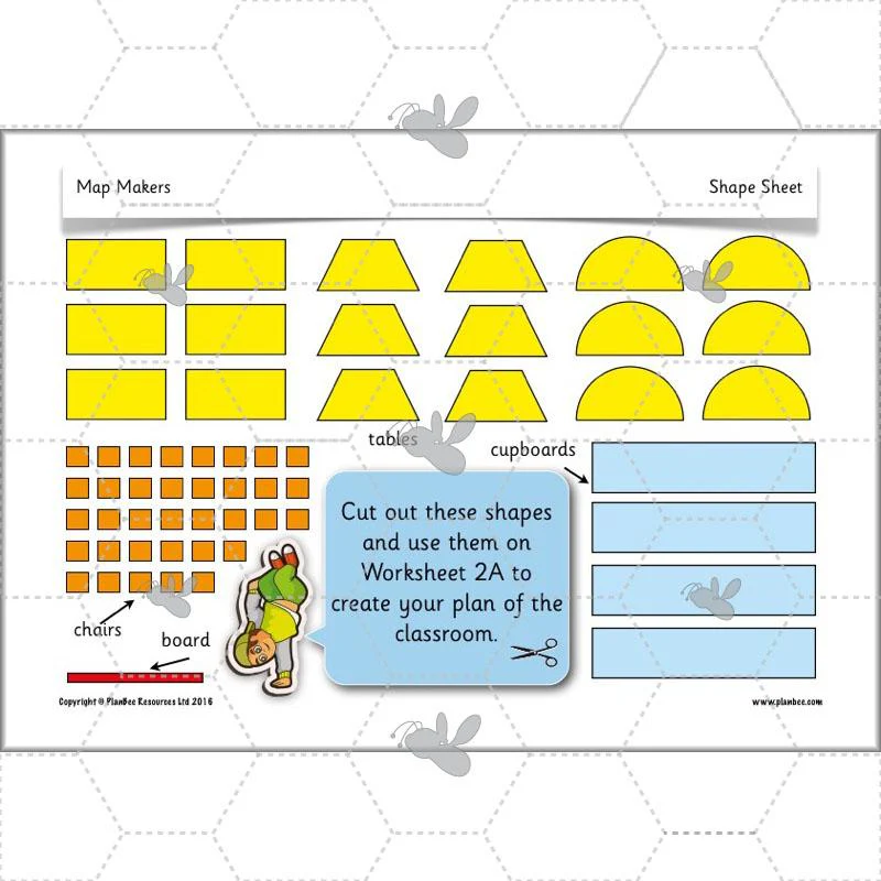
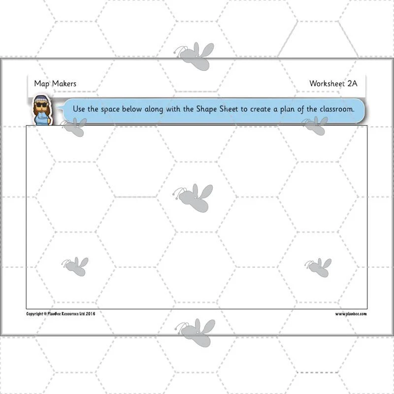
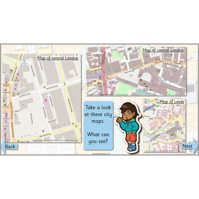
The second lesson in this scheme of work gives your class the opportunity to discover aerial photos and plan perspectives. They will be shown different aerial views and challenged to see if they can guess the location the photo is showing. Your children will learn how arial photos help cartographers to make maps. They will then go on to look at different aerial views and plan perspectives before creating a plan of their own.
This downloadable lesson includes a lesson plan, a slideshow presentation and printable teaching resources.
What's included:
- Lesson plan
- Slides
- Activity ideas
- Differentiated worksheets
- Plan view example sheet
- Shape sheet
View Lesson 2
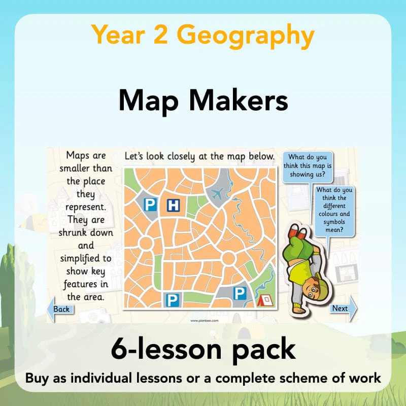
Reading Maps
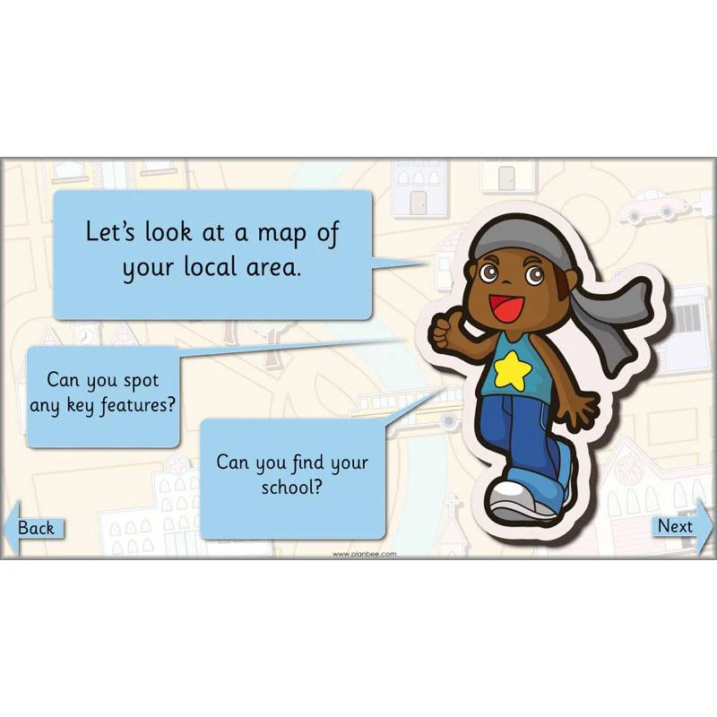
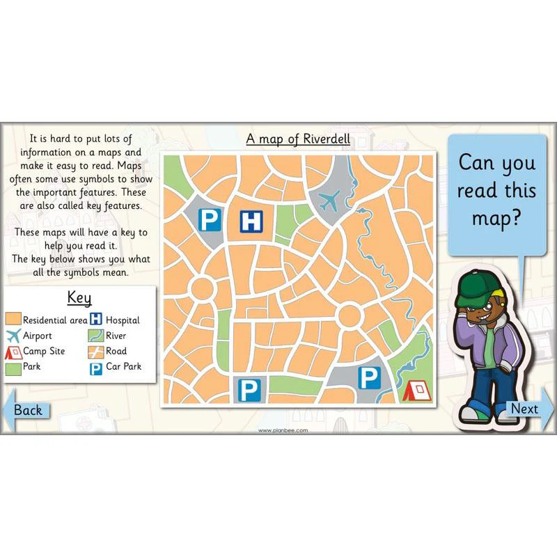
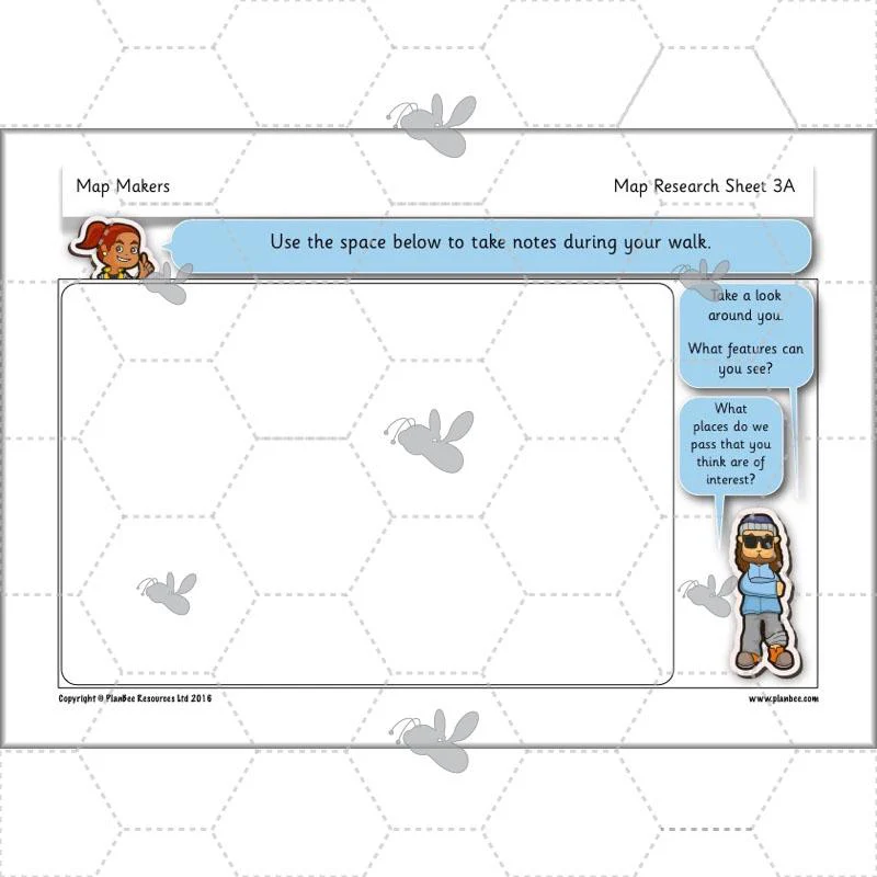
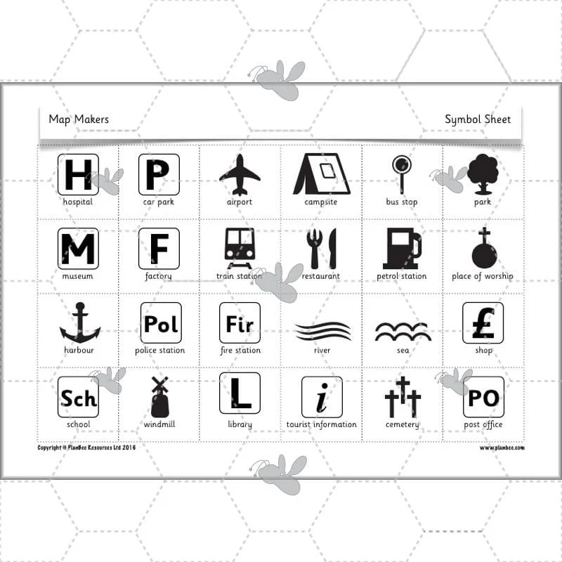
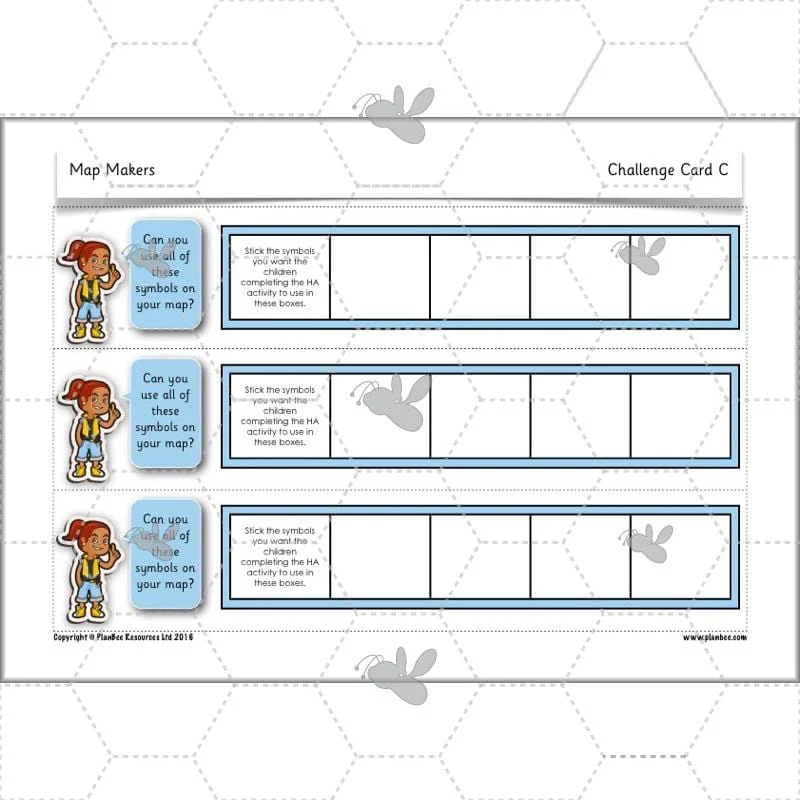
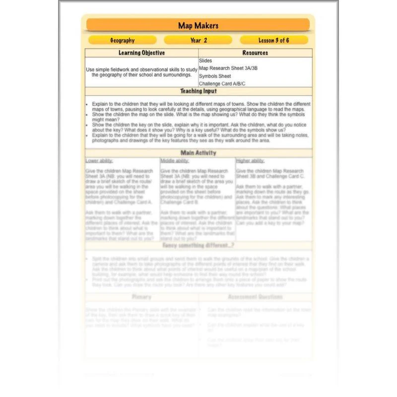
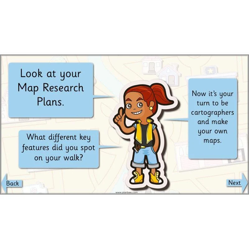
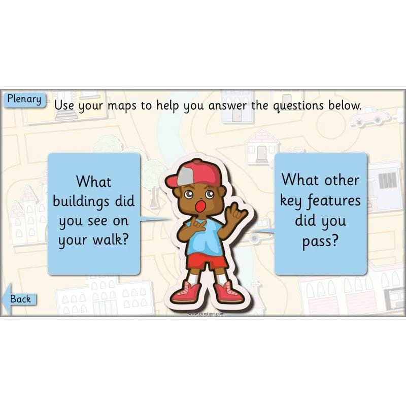
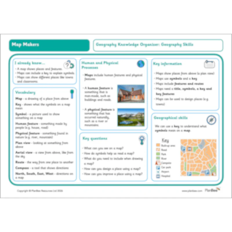
The third lesson in this scheme of work allows the children to explore the area surrounding their school. Your class will look closely at different maps and use geographical language to describe what they can see. The children will also learn the importance of using a key to help read a map and the key features it shows. They will investigate their surrounding area by going on a local walk and taking notes and photographs of the key features along the route.
This downloadable lesson includes a lesson plan, a slideshow presentation and printable teaching resources.
What's included:
- Lesson plan
- Slides
- Activity ideas
- Differentiated map research sheets
- Symbols sheet
- Differentiated challenge cards
View Lesson 3
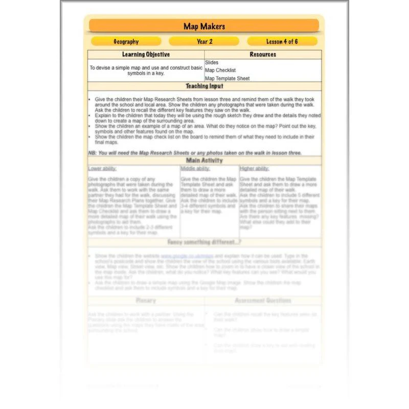
Making Maps
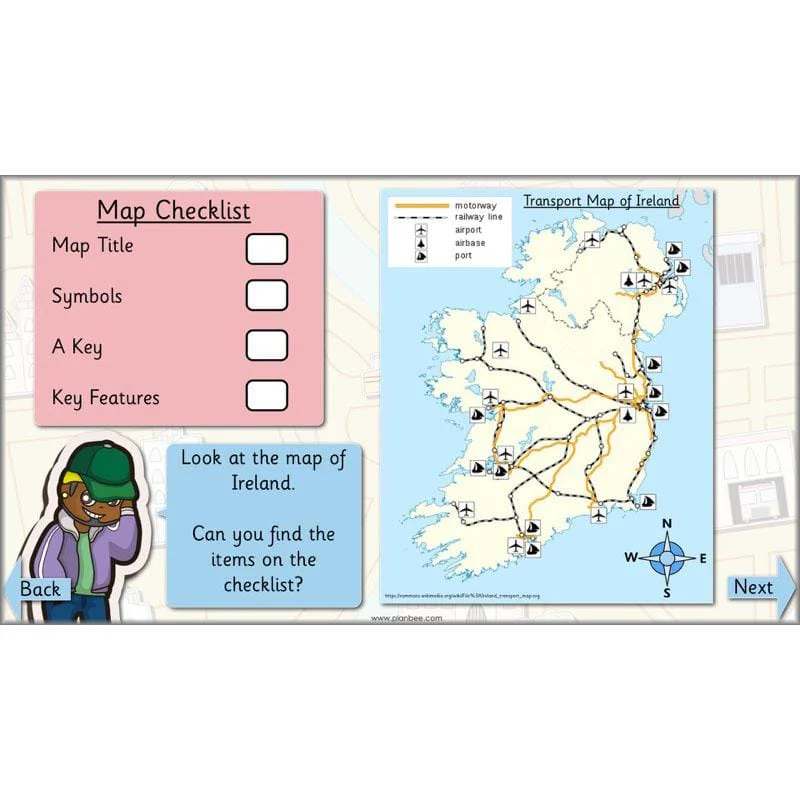
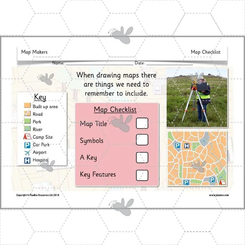
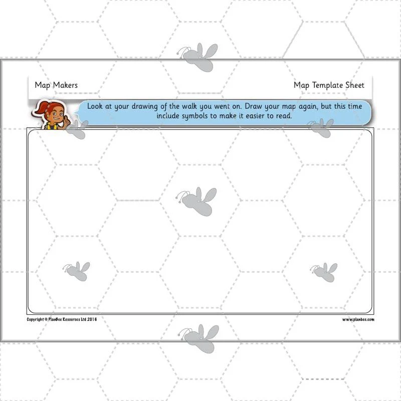
During the fourth lesson in this scheme of work your class will be using the notes and photographs taken on their walk in the previous lesson. They will use the information they gathered or a digital map to create their own simple map and construct a key.
This downloadable lesson includes a lesson plan, a slideshow presentation and printable teaching resources.
What's included:
- Lesson plan
- Slides
- Activity ideas
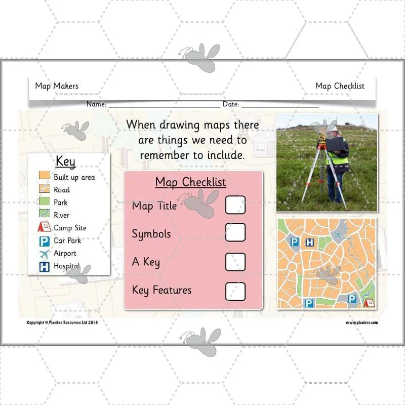
- Map checklist
- Map template sheet
View Lesson 4
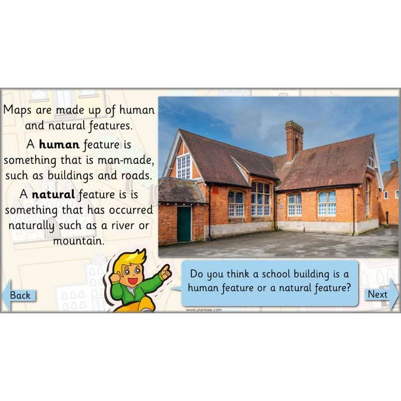
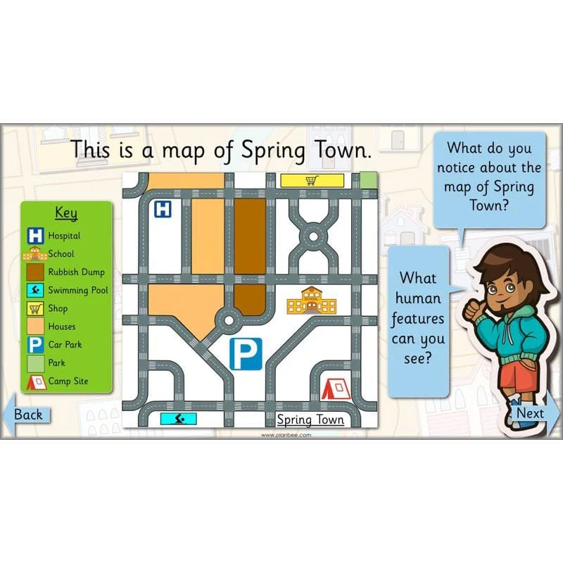
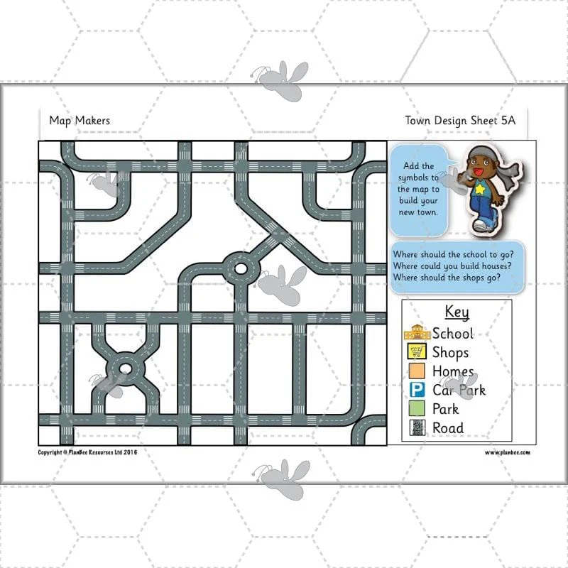
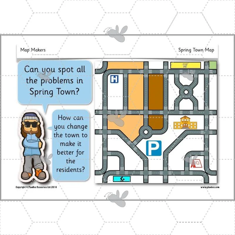
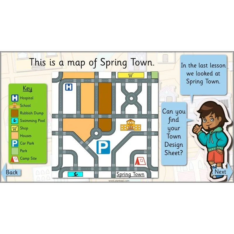
Designing a Map
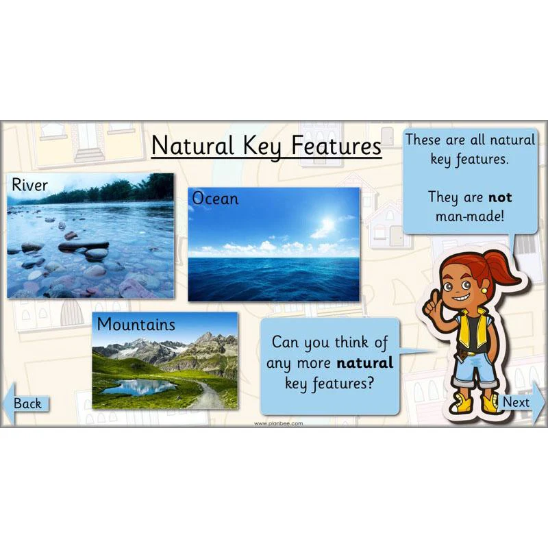
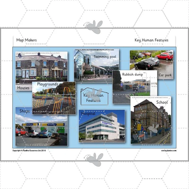
The fifth lesson in this scheme of work looks at human features and natural features. Your class will take a close look at the map of a town that needs help! Your children will then go on to design their own town, complete with human features and physical features. This lesson includes lots of opportunities to discuss how important it is to think carefully about the layout of a town, before you begin to create the plan.
This downloadable lesson includes a lesson plan, a slideshow presentation and printable teaching resources.
What's included:
- Lesson plan
- Slides
- Activity ideas
- Differentiated town design sheets
- Key features sheet
- Spring Town map
- Blank Spring Town map
View Lesson 5
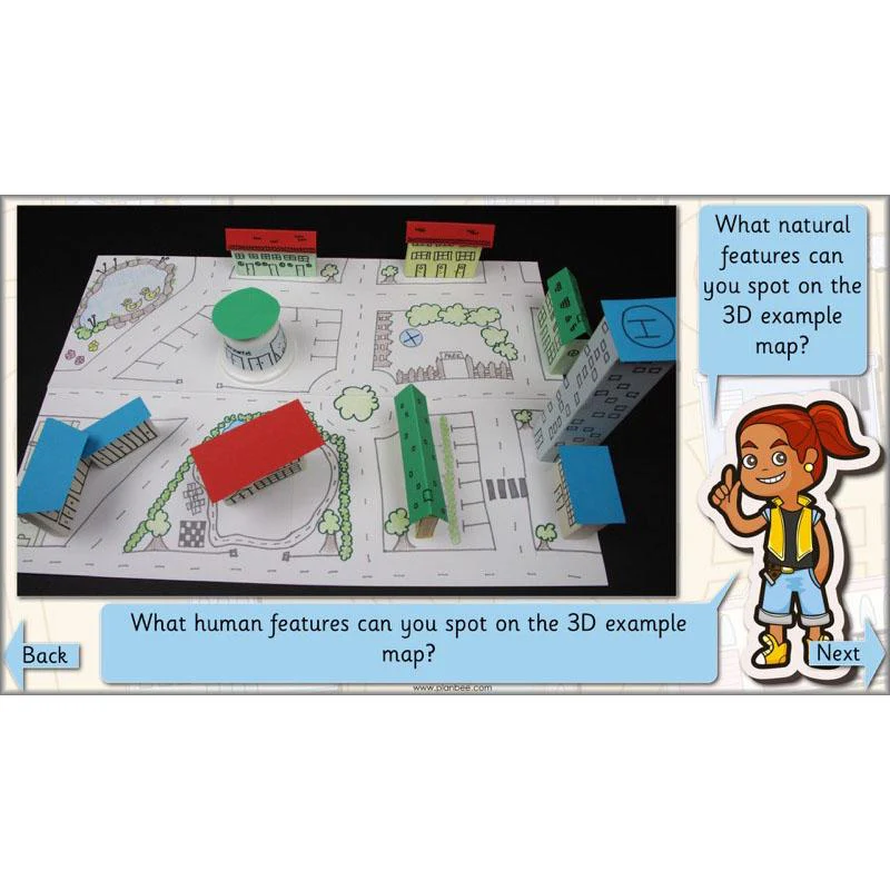
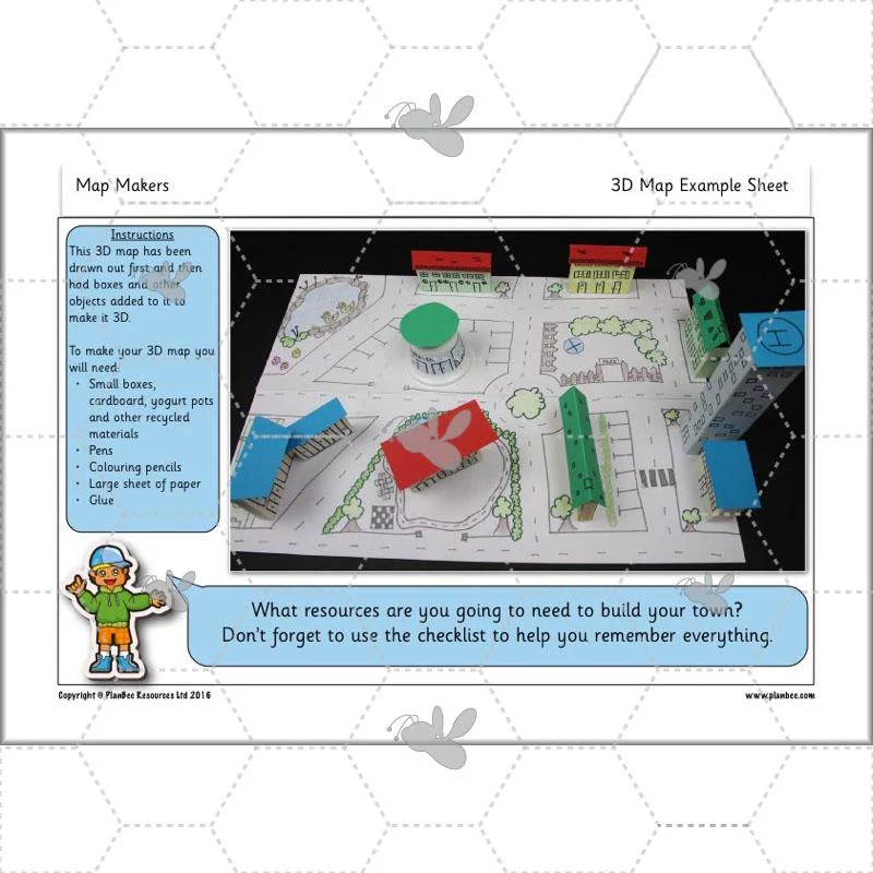
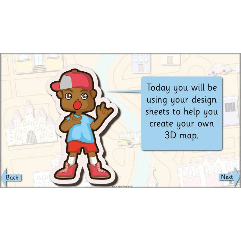
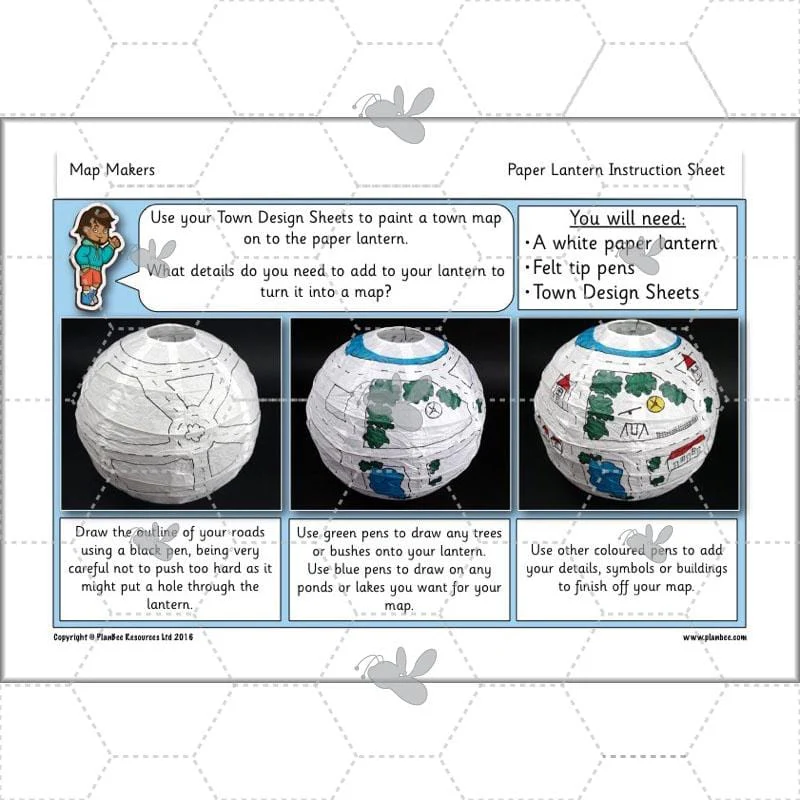
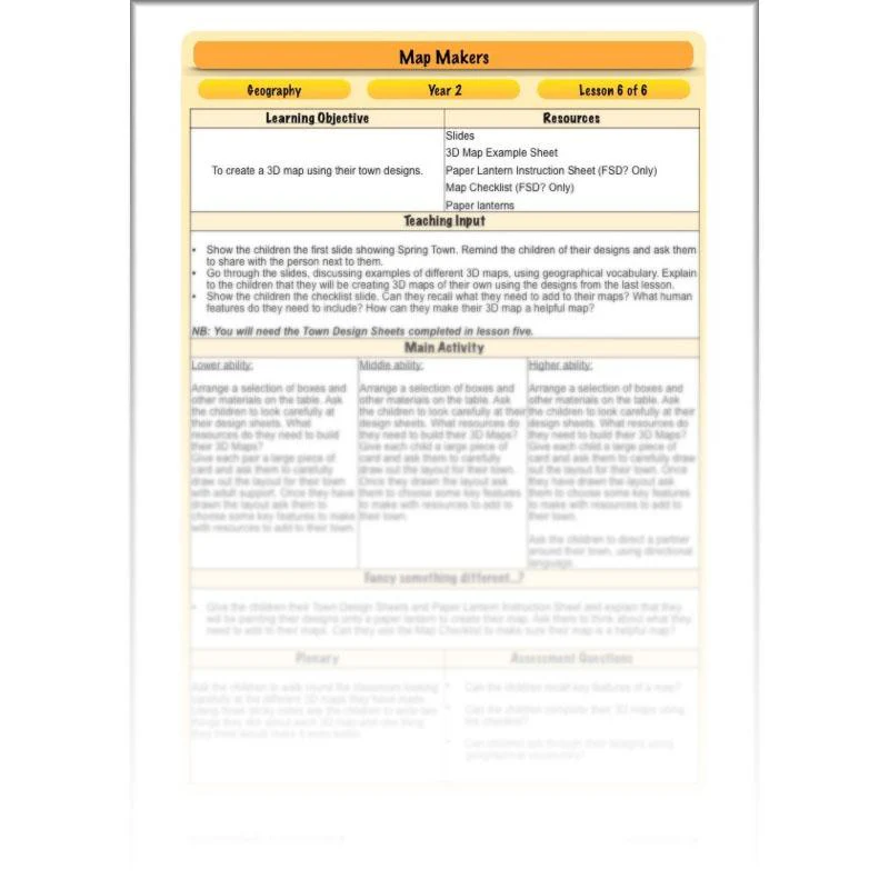
3D Maps
The final lesson in this scheme of work gives your class the opportunity to apply their knowledge on maps and create a 3D map of their own made-up town. There is also the opportunity for your children to put into practise all the geographical language they have learnt as they guide their classmates around their towns. The alternative activity for this lesson gives your class the chance to use their designs to create an amazing lantern map.
This downloadable lesson includes a lesson plan, a slideshow presentation and printable teaching resources.
What's included:
- Lesson plan
- Slides
- Activity ideas
- 3D map examples sheet
- Map checklist
- Paper lantern instruction sheet
View Lesson 6
Original: $2.69
-65%$2.69
$0.94More Images


Map Makers
Give your class the opportunity to learn all about maps and the geography of their surrounding area with these 'Map Makers' lessons for Year 2. Your class will find out why we use maps and how to read them, as well as having the opportunity to draw their own maps and plan perspectives.
This scheme of work provides opportunities for your class to perfect their map reading skills and put them into practise in school and the surrounding local area. These KS1 'Map Makers' lessons are sure to have your class excited about making and using maps! This downloadable series of lessons includes lesson plans, slideshow presentations and printable teaching resources.
Compass Points
The first lesson in this scheme of work introduces your class to maps. Your children will explore different uses of maps, asking the questions, ‘What are maps?’, ‘Where do we find them?’ and ‘What do we use them for?’ Your class will learn about directional language and how to move around a map using the points of a compass. Different types of maps will be shown in this lesson and children will begin to understand what these maps show and how they help us.
This downloadable lesson includes a lesson plan, a slideshow presentation and printable teaching resources.
What's included:
- Lesson plan
- Slides
- Activity ideas
- Differentiated treasure maps
- Pirate game sheet
- Treasure chest sheet
- Compass sheet
View Lesson 1
Aerial Views and Plan Perspectives
The second lesson in this scheme of work gives your class the opportunity to discover aerial photos and plan perspectives. They will be shown different aerial views and challenged to see if they can guess the location the photo is showing. Your children will learn how arial photos help cartographers to make maps. They will then go on to look at different aerial views and plan perspectives before creating a plan of their own.
This downloadable lesson includes a lesson plan, a slideshow presentation and printable teaching resources.
What's included:
- Lesson plan
- Slides
- Activity ideas
- Differentiated worksheets
- Plan view example sheet
- Shape sheet
View Lesson 2
Reading Maps
The third lesson in this scheme of work allows the children to explore the area surrounding their school. Your class will look closely at different maps and use geographical language to describe what they can see. The children will also learn the importance of using a key to help read a map and the key features it shows. They will investigate their surrounding area by going on a local walk and taking notes and photographs of the key features along the route.
This downloadable lesson includes a lesson plan, a slideshow presentation and printable teaching resources.
What's included:
- Lesson plan
- Slides
- Activity ideas
- Differentiated map research sheets
- Symbols sheet
- Differentiated challenge cards
View Lesson 3
Making Maps
During the fourth lesson in this scheme of work your class will be using the notes and photographs taken on their walk in the previous lesson. They will use the information they gathered or a digital map to create their own simple map and construct a key.
This downloadable lesson includes a lesson plan, a slideshow presentation and printable teaching resources.
What's included:
- Lesson plan
- Slides
- Activity ideas
- Map checklist
- Map template sheet
View Lesson 4
Designing a Map
The fifth lesson in this scheme of work looks at human features and natural features. Your class will take a close look at the map of a town that needs help! Your children will then go on to design their own town, complete with human features and physical features. This lesson includes lots of opportunities to discuss how important it is to think carefully about the layout of a town, before you begin to create the plan.
This downloadable lesson includes a lesson plan, a slideshow presentation and printable teaching resources.
What's included:
- Lesson plan
- Slides
- Activity ideas
- Differentiated town design sheets
- Key features sheet
- Spring Town map
- Blank Spring Town map
View Lesson 5
3D Maps
The final lesson in this scheme of work gives your class the opportunity to apply their knowledge on maps and create a 3D map of their own made-up town. There is also the opportunity for your children to put into practise all the geographical language they have learnt as they guide their classmates around their towns. The alternative activity for this lesson gives your class the chance to use their designs to create an amazing lantern map.
This downloadable lesson includes a lesson plan, a slideshow presentation and printable teaching resources.
What's included:
- Lesson plan
- Slides
- Activity ideas
- 3D map examples sheet
- Map checklist
- Paper lantern instruction sheet
View Lesson 6
Product Information
Product Information
Shipping & Returns
Shipping & Returns
Description
Give your class the opportunity to learn all about maps and the geography of their surrounding area with these 'Map Makers' lessons for Year 2. Your class will find out why we use maps and how to read them, as well as having the opportunity to draw their own maps and plan perspectives.
This scheme of work provides opportunities for your class to perfect their map reading skills and put them into practise in school and the surrounding local area. These KS1 'Map Makers' lessons are sure to have your class excited about making and using maps! This downloadable series of lessons includes lesson plans, slideshow presentations and printable teaching resources.
Compass Points
The first lesson in this scheme of work introduces your class to maps. Your children will explore different uses of maps, asking the questions, ‘What are maps?’, ‘Where do we find them?’ and ‘What do we use them for?’ Your class will learn about directional language and how to move around a map using the points of a compass. Different types of maps will be shown in this lesson and children will begin to understand what these maps show and how they help us.
This downloadable lesson includes a lesson plan, a slideshow presentation and printable teaching resources.
What's included:
- Lesson plan
- Slides
- Activity ideas
- Differentiated treasure maps
- Pirate game sheet
- Treasure chest sheet
- Compass sheet
View Lesson 1
Aerial Views and Plan Perspectives
The second lesson in this scheme of work gives your class the opportunity to discover aerial photos and plan perspectives. They will be shown different aerial views and challenged to see if they can guess the location the photo is showing. Your children will learn how arial photos help cartographers to make maps. They will then go on to look at different aerial views and plan perspectives before creating a plan of their own.
This downloadable lesson includes a lesson plan, a slideshow presentation and printable teaching resources.
What's included:
- Lesson plan
- Slides
- Activity ideas
- Differentiated worksheets
- Plan view example sheet
- Shape sheet
View Lesson 2
Reading Maps
The third lesson in this scheme of work allows the children to explore the area surrounding their school. Your class will look closely at different maps and use geographical language to describe what they can see. The children will also learn the importance of using a key to help read a map and the key features it shows. They will investigate their surrounding area by going on a local walk and taking notes and photographs of the key features along the route.
This downloadable lesson includes a lesson plan, a slideshow presentation and printable teaching resources.
What's included:
- Lesson plan
- Slides
- Activity ideas
- Differentiated map research sheets
- Symbols sheet
- Differentiated challenge cards
View Lesson 3
Making Maps
During the fourth lesson in this scheme of work your class will be using the notes and photographs taken on their walk in the previous lesson. They will use the information they gathered or a digital map to create their own simple map and construct a key.
This downloadable lesson includes a lesson plan, a slideshow presentation and printable teaching resources.
What's included:
- Lesson plan
- Slides
- Activity ideas
- Map checklist
- Map template sheet
View Lesson 4
Designing a Map
The fifth lesson in this scheme of work looks at human features and natural features. Your class will take a close look at the map of a town that needs help! Your children will then go on to design their own town, complete with human features and physical features. This lesson includes lots of opportunities to discuss how important it is to think carefully about the layout of a town, before you begin to create the plan.
This downloadable lesson includes a lesson plan, a slideshow presentation and printable teaching resources.
What's included:
- Lesson plan
- Slides
- Activity ideas
- Differentiated town design sheets
- Key features sheet
- Spring Town map
- Blank Spring Town map
View Lesson 5
3D Maps
The final lesson in this scheme of work gives your class the opportunity to apply their knowledge on maps and create a 3D map of their own made-up town. There is also the opportunity for your children to put into practise all the geographical language they have learnt as they guide their classmates around their towns. The alternative activity for this lesson gives your class the chance to use their designs to create an amazing lantern map.
This downloadable lesson includes a lesson plan, a slideshow presentation and printable teaching resources.
What's included:
- Lesson plan
- Slides
- Activity ideas
- 3D map examples sheet
- Map checklist
- Paper lantern instruction sheet
View Lesson 6